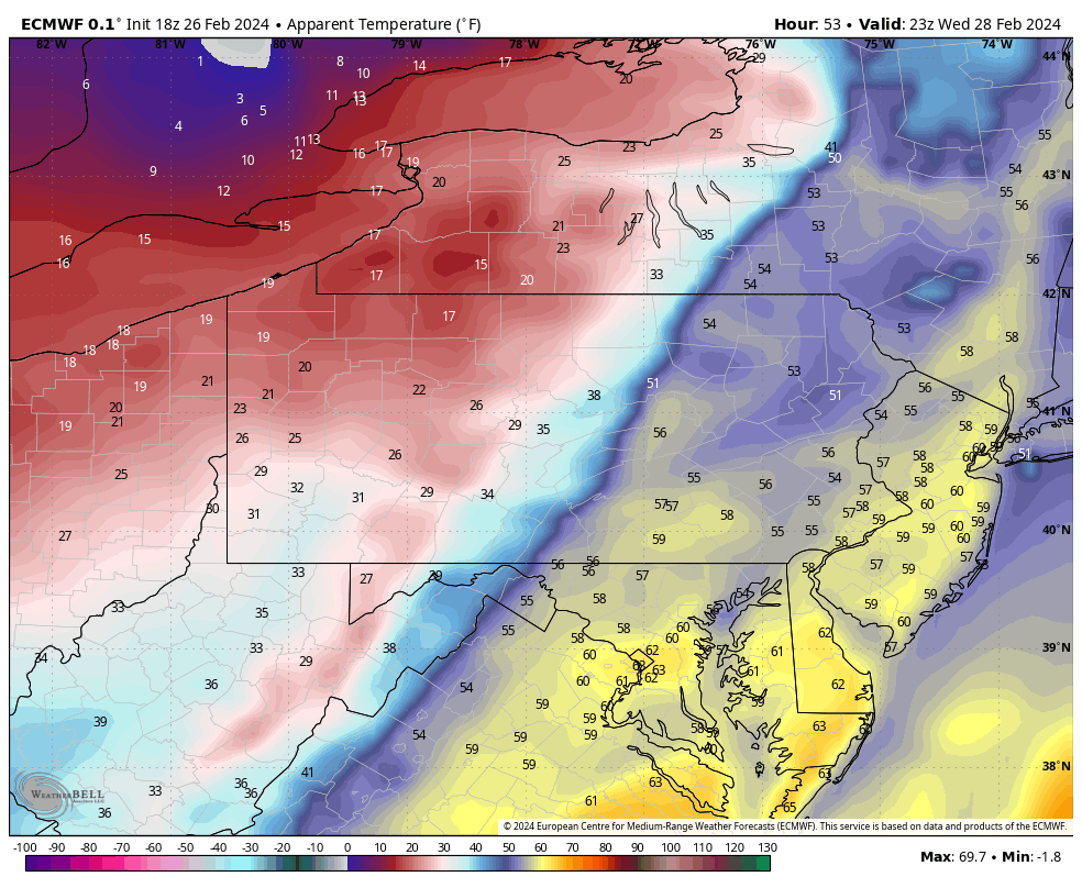
Temperatures are going to skyrocket over the next couple of days! As a matter of fact, both Tuesday’s and Wednesday’s projected highs are normal for the middle of April. Certainly not unheard of for this time of year, but pretty warm considering the time of year. We’ll likely fall short of the record high on Tuesday, but Wednesday could be a close call. The record is 68, we’re forecasting 65. If we can hold most of the moisture off until late in the day we may have a shot.
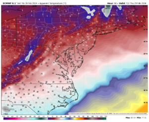
The warm up will be short lived as a powerful cold front arrives Wednesday night. This front will bring a pretty dramatic change to the area. Spring-like temperatures that will top out in the mid 60s Wednesday will give way to wind chills in the teens first thing Thursday morning. That will sting a little bit! Thankfully this cold shot does not last very long. About two days to be exact and then we start warming up again for the weekend!