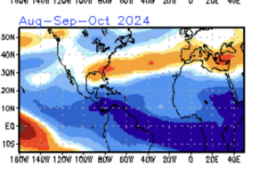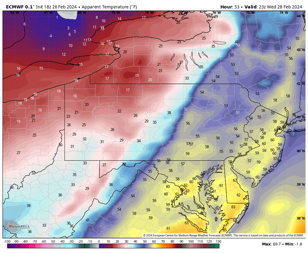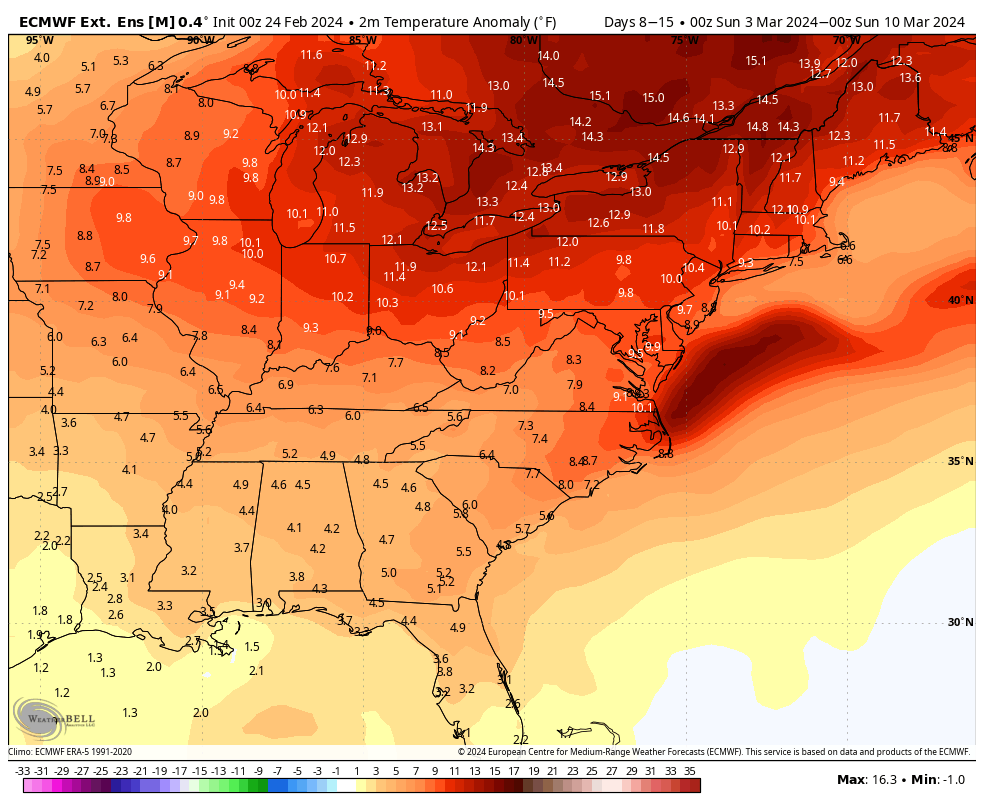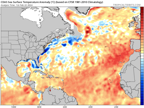
It seems like we say this every year now. This could be another incredibly busy hurricane season in the Atlantic basin! Two things we’re concerned about… first, temperatures in the tropical Atlantic are already pretty close to where they should be during the start of hurricane season. The image above is a look at temperature anomalies. You can clearly see how warm the water is. Water temperatures above 80 degrees promote tropical development. But you can get sub-tropical development with cooler water as long as everything else comes in to play just right. We’ve seen tropical and sub-tropical development pretty early in the year over the past couple of season. The second thing we’re concerned about is the latest shear projections coming from the CFSv2 during the heart of hurricane season. The image below shows very low levels. Wind shear rips storms apart because the strong synoptic winds aloft, that are blowing in the opposite direction that the storm is traveling, force the upper part of the storm away from the surface part. Think of a three layer stack of pancakes with the bottom pancake being the surface part of the storm and the top pancake being the upper level part of the storm. The shear would take the top pancake and move it away from the other two. This process collapses the storm, inhibiting development and often times destroying it. Shear can be the southeast coasts best friend as it often times weakens approaching storms. So without this protection, the coastline is going to be very vulnerable.